Latest Forecast From Storm Team 4
The big swings in weather we’ve experienced in the past few days are set to continue.
Up next, a front will meander back and forth across the tri-state and bring more weather changes in the form of dramatic temperature swings and several shower chances. So keep the coats, T-shirts and umbrellas at the ready — you’re going to need them all.
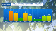
After stubborn temperatures in the 40s on Wednesday, 60s and 70s return on Thursday. This spike in temperatures comes with showers that replace Wednesday’s sunshine. Thursday won’t be a washout, but you can expect gray skies with hit-and-miss pockets of rain.
Watch NBC 4 free wherever you are
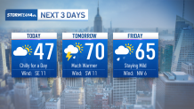
The rain will pick up heading into early Friday morning, in time for the commute. Heavier downpours and a few rumbles of thunder are possible.
Get Tri-state area news delivered to your inbox with NBC New York's News Headlines newsletter.
If you get caught in a downpour on your way to work Friday, a little common sense will go a long way. Take it slow and leave extra space between you and the car in front of you.

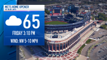
Showers should move out early Friday, leaving most of the day dry and mild, as warm air remains in place. That’s good news for the Mets’ home opener at 3:10 p.m. Friday afternoon. Just anticipate the lingering clouds.
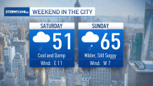
The mild air will be shoved aside by Saturday, as cool air spills into the region. Highs will once again struggle to break 50 on Saturday, and showers will make the start of the weekend a soggy one. Make sure you have a raincoat and umbrella with you on your way outside.
Weather Stories
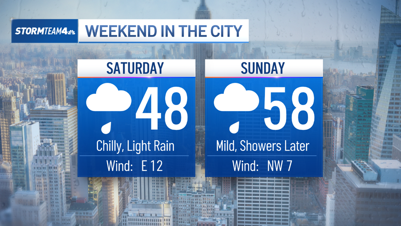

Yet more changes happen Sunday, as warm air surges back and sends temperatures into the 60s. Showers will remain, with the evening will be the wettest part of the day.
By Monday, the cold front will push through the area one last time and bring a more prolonged cool and dry stretch of weather that will last through most of next week.