
We’ve been dealing with isolated pockets of showers and storms this week, and the unsettled weather is set to continue with storms back in the forecast through Thursday.
After a relatively quiet weather stretch for the tri-state area, and you'll want to keep the umbrella within reach for whatever pops up.
A series of low pressure systems have been moving through the area this week, keeping most of us cloudy, muggy and damp for days. We’re waiting for a cold front to come through at the end of this week and finally dry us out. But until then, it’s more of the same.
Watch NBC 4 free wherever you are
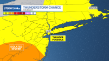
Thankfully, we are not expecting the levels of heat and instability we saw last week, meaning the threat of severe weather is significantly lower than it was. That said, there is still a chance for thunderstorms Thursday.
Get Tri-state area news delivered to your inbox with NBC New York's News Headlines newsletter.
While severe weather is not likely for many, isolated storms could show enough gusto to prompt one or two stronger thunderstorms at some point. Any weather alerts that pop up would likely be issued because of the threat of damaging straight-line wind gusts. Check the latest weather alerts for your neighborhood here.
Weather Stories
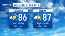
Here's a breakdown ahead of the weekend, which does look to be quite promising:
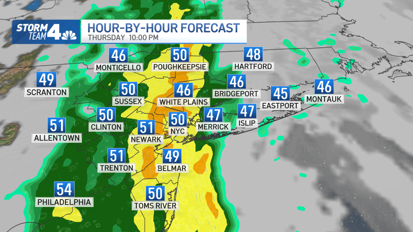
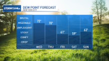
THURSDAY
Thursday is another predominantly sticky and gray day. Scattered storms could return ahead of a cold front in the evening while a tropical airmass sticks around, though most of the severe weather risk will stay in central and southern New Jersey.
The rest of the area will just see the chance for isolated storms that could bring some thunder, but nothing terribly severe. Showers will be few and far between for most of us.
This will set us up for a beautiful end to the week with rain-free skies and lower humidity.
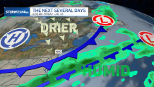
Looking ahead to the weekend, a passing cold front will that moves through after Thursday will bring a pleasant change in the weather pattern.
Heading into the weekend, not only will we be rain-free, but sunshine will return and humidity will be significantly lower. We end the week with much better weather than when we started.
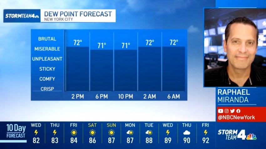
Highs will be in the mid to upper 80s, typical for this time of year, with more reasonable levels of humidity.
For those on summer vacation: It will stay warm, sunny and dry, making for great beach weather.
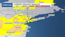
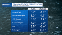
SUMMER DROUGHT
The tri-state could certainly use any rain it sees through the end of the week, as abnormally dry or moderate drought conditions have developed across a large portion of the area this summer.
New York City and neighboring counties in the Hudson Valley, New Jersey and on Long Island are officially considered dry, while there are pockets of northern, western and central New Jersey that are in a moderate drought.
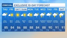
Check out the 10-day NYC forecast below.
Track any approaching rain using our interactive radar below.