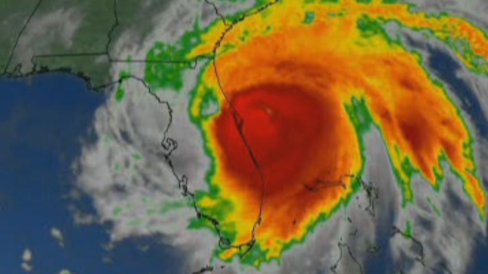
The primary threats with this system will be destructive winds and potentially rapid rainfall; an isolated tornado, though, isn't out of the question. Here's the latest forecast breakdown for tonight's storms
A line of strong to severe storms is headed to the tri-state are Monday night. Damaging wind gusts, large hail, isolated flooding and even an isolated tornado are possible.
And the timing could make the evening commute a tricky one.
Watch NBC 4 free wherever you are

By late afternoon, isolated storms will begin popping up mainly to the west and northwest of New York City. They will not be widespread, but where they do develop, they’ll produce heavy rain and gusty winds.
Get Tri-state area news delivered to your inbox with NBC New York's News Headlines newsletter.
If you get caught in one of these, expect reduced visibility and hazardous driving conditions. Thankfully, the heaviest and most widespread storms don’t move in until after the peak of the evening rush.
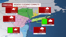
The main event will push into the area after dinnertime. If you have to be out late Monday, anticipate tough travel through midnight, with heavy downpours and strong wind gusts the biggest hazards.
Check the latest weather alerts for your neighborhood here.
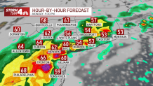
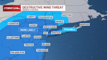
Wind gusts could exceed 60 miles per hour, which could knock down tree limbs and cause power outages.
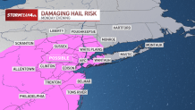
Quarter-sized hail is also possible. It can cause minor property damage to the roof of your car and your house. If you can, keep your car in a sheltered space to avoid waking up to small dents or cracked windshields.
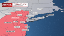
While not a big threat, an isolated tornado or two can’t be ruled out tonight, especially west of the city. Make sure you have a way to get alerts on your phone or another way in case a tornado warning is issued for your area.
Check the latest weather alerts for your neighborhood here.
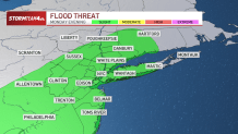
Overall, these storms will deliver a substantial amount of rain to the tri-state, especially along the I-95 corridor, where the heaviest pockets of rain will set up for a couple of hours.
In those spots, one to two inches of rain are likely, with isolated higher amounts. The rest of the area can expect anywhere from a half inch to an inch of rain, while those further north and west in the Hudson Valley will see comparatively lower totals, likely less than a half inch.
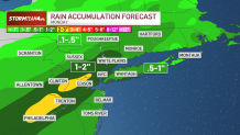
This amount of rain falling over a relatively condensed period of time will lead to minor flooding, especially in low-lying areas.
Storms will begin exiting after midnight, leaving Tuesday morning’s commute much drier than Monday evening’s drive. Just anticipate residual ponding on the roads, especially if you’re out early.
Weather Stories
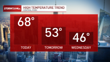
But Tuesday’s drier air is coming along with a considerable temperature drop. We’ll be welcoming April with brighter skies and much cooler temperatures.
Enjoy the brief break from the showers; it won’t be long before rain chances (and our temperatures) spike again.
