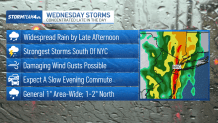
Potentially severe thunderstorms with wild winds are expected to wallop parts of New Jersey though much of Wednesday evening, as heavy rain and strong gusts made the evening commute a tricky one for drivers in the New York City area.
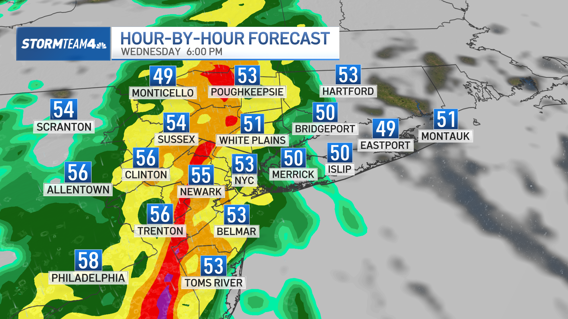
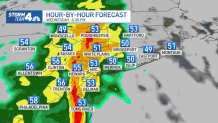
After a relatively dry, though gray, Wednesday morning, steady rain started moving through the tri-state by the afternoon. The Hudson Valley, Catskills, and Poconos were the first to experience the wet weather, but the entire region started to feel the impact in time for the P.M. commute. (Here's an hourly breakdown of projected radar through the storms.)
More weather

Watch NBC 4 free wherever you are
Get Tri-state area news delivered to your inbox with NBC New York's News Headlines newsletter.
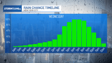
How long will the rain last?
Between 5 p.m. and 8 p.m., a heavy line of showers and storms spread over the region. This timing made for an abysmal evening commute, with the worst of the rain and storms coming down when roads are most congested. Those getting caught in downpours would have dealt with periods of low visibility while on the roads.
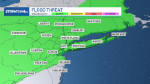
The periods of heavy rain also had the risk of leading to minor flooding, especially in low-lying or poor-drainage areas. Take extra caution if your drive takes you over a flood-prone roadway; the last thing you want is for your car to start hydroplaning.
Damaging winds, thunderstorms expected
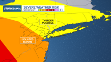
Not only did the storms bring heavy rainfall, but some had potential to be strong or severe. Central and South Jersey looked to get the strongest storms, but weaker, non-severe thunderstorms were likely through the Hudson Valley, Connecticut, NYC and Long Island. So don’t be surprised if you hear a few rumbles of thunder.
Check the latest weather alerts for your neighborhood here.
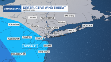
The greatest severe threat associated with these storms will be strong, damaging wind gusts. The entire area will be experiencing gusts between 30 and 40 mph, but those caught in the stronger storms could record wind gusts up to 60 mph.
The winds and rain helped take down trees and wires throughout the area, leading to damage and some closed streets in northern New Jersey and into Westchester County. Make sure to secure your garbage cans, outdoor furniture, and decorations so they don’t end up flying into the street or your neighbor’s yard.
As a precaution against strong winds, the MTA said it was banning tractor-trailers and tandem trucks on its bridges from 10 a.m. Wednesday through 6 a.m. Thursday.
The good news: the line of storms will move through quickly and skies will already be drying out before midnight.
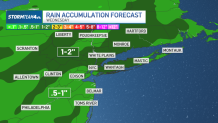
Generally, we can expect about an inch of rain across the tri-state, with totals up to 2 inches in areas where the heaviest pockets of rain set up.
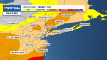
The rain is sorely needed. We haven’t fully recovered from last fall’s drought, so most places are still experiencing moderate to severe drought conditions. A solid soaking will be an inconvenience, but it will be good for the region.
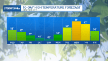
Cooler air moves in behind the rain. It won’t be the dramatic arctic rush we experienced last weekend but expect a 5-to-10 degree cooldown by the end of the week – delivering near average temperatures for early March.
But if you’re a warm weather lover, don’t fret. Temperatures are climbing into the mid 60s next week!