


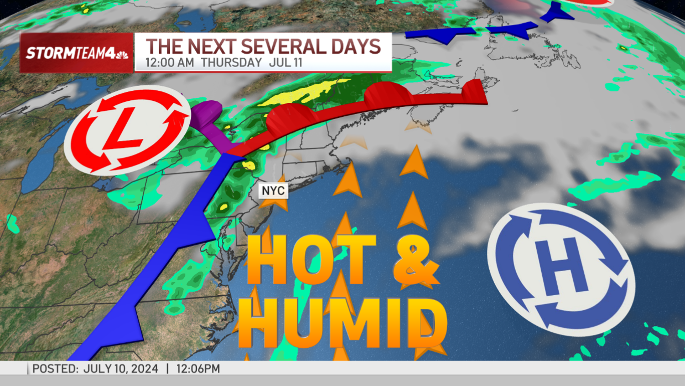
Powerful storms are expected to descend on the tri-state area Wednesday afternoon into the evening hours, dumping buckets of rain on the region -- and threatening to spawn tornadoes -- after a mercilessly hot and humid stretch.
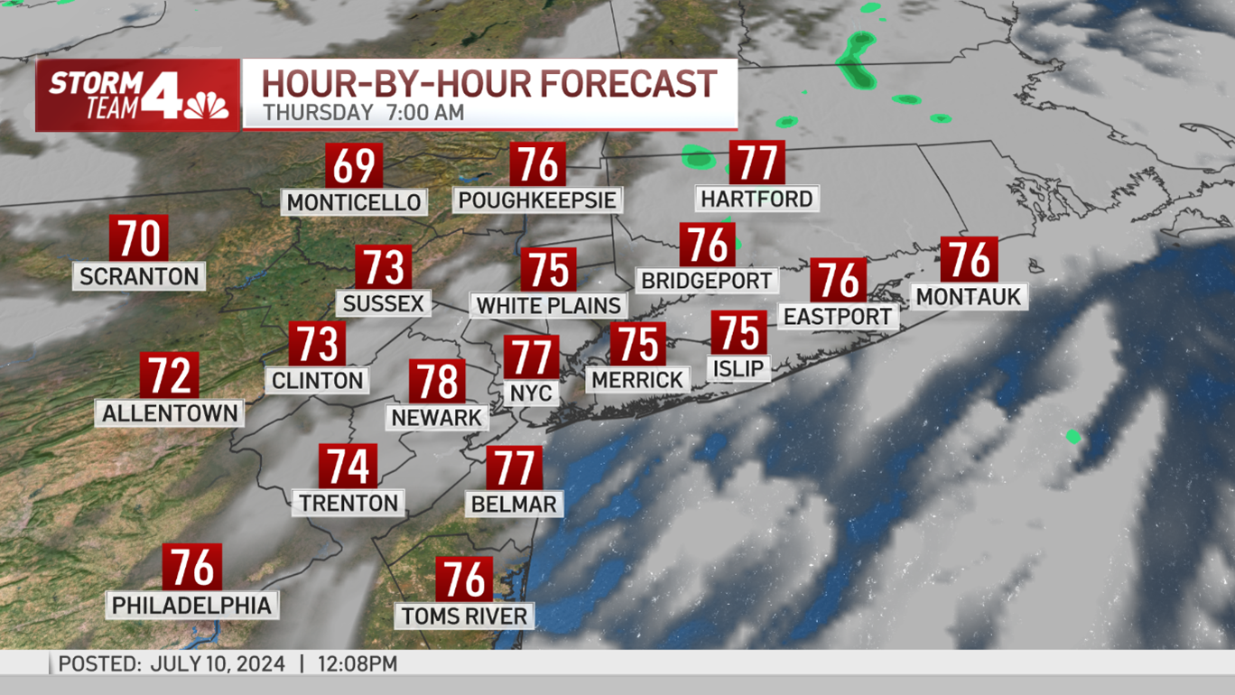
The upcoming weather won't do much for the heat oppression, unfortunately, but there is a bit of good news: The cold front will push the super-humid air just offshore, leaving the tri-state a bit more comfortable through Thursday. It will be just a one-day reprieve, so enjoy it.
Heat advisories expired at 8 p.m. Wednesday, and there is not one expected to be issued Thursday.
Along with our prolonged bout with extreme heat, our chances for showers and storms are on the rise as a cold front associated with the remnants of Hurricane Beryl moves into the region.

Get Tri-state area news delivered to your inbox. Sign up for NBC New York's News Headlines newsletter.
Storm timing
Weather Stories

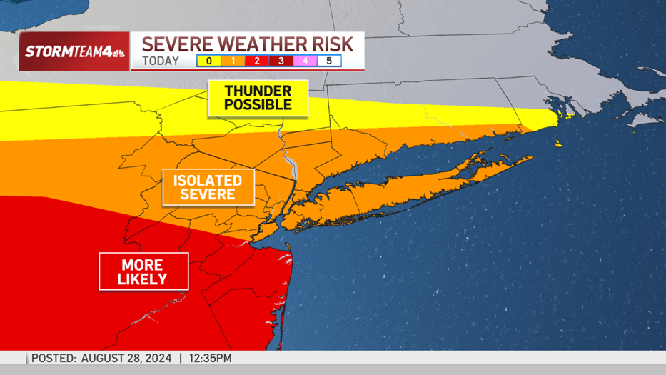

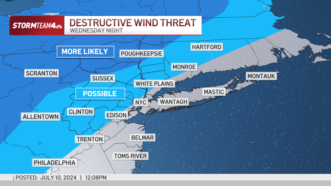
A line of storms will make its way into the tri-state area by late evening, with the strongest storms impacting areas primarily north and west of the city. Pike, Sullivan, and Ulster Counties are at the highest relative risk for severe weather Wednesday night.
Check the latest severe weather alerts for your neighborhood here.

As storms advance south and east they will weaken and eventually fall apart entirely. By 2 a.m. on Thursday, the severe threat is largely diminished, though remnant showers could make their way toward the coast by dawn.
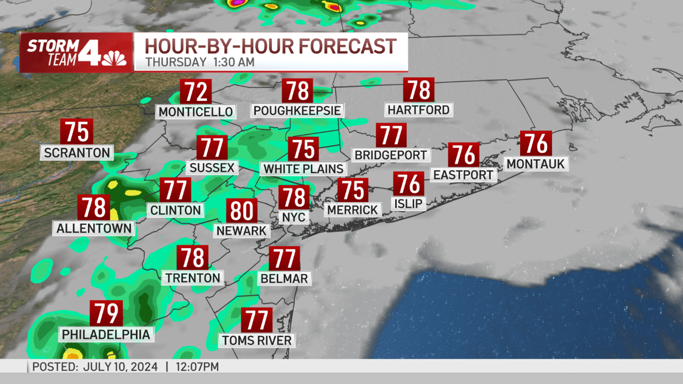
By the heart of the Thursday morning’s commute, there should be little more than a lingering sprinkle or two.
Severe weather threats
For the severe storms that do develop, the primary threat is damaging wind gusts up to 60 mph. At that speed, winds can blow off tree branches, knock down power lines, and damage property.
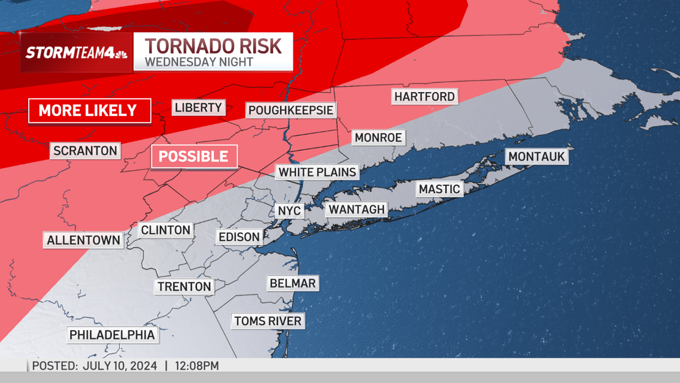
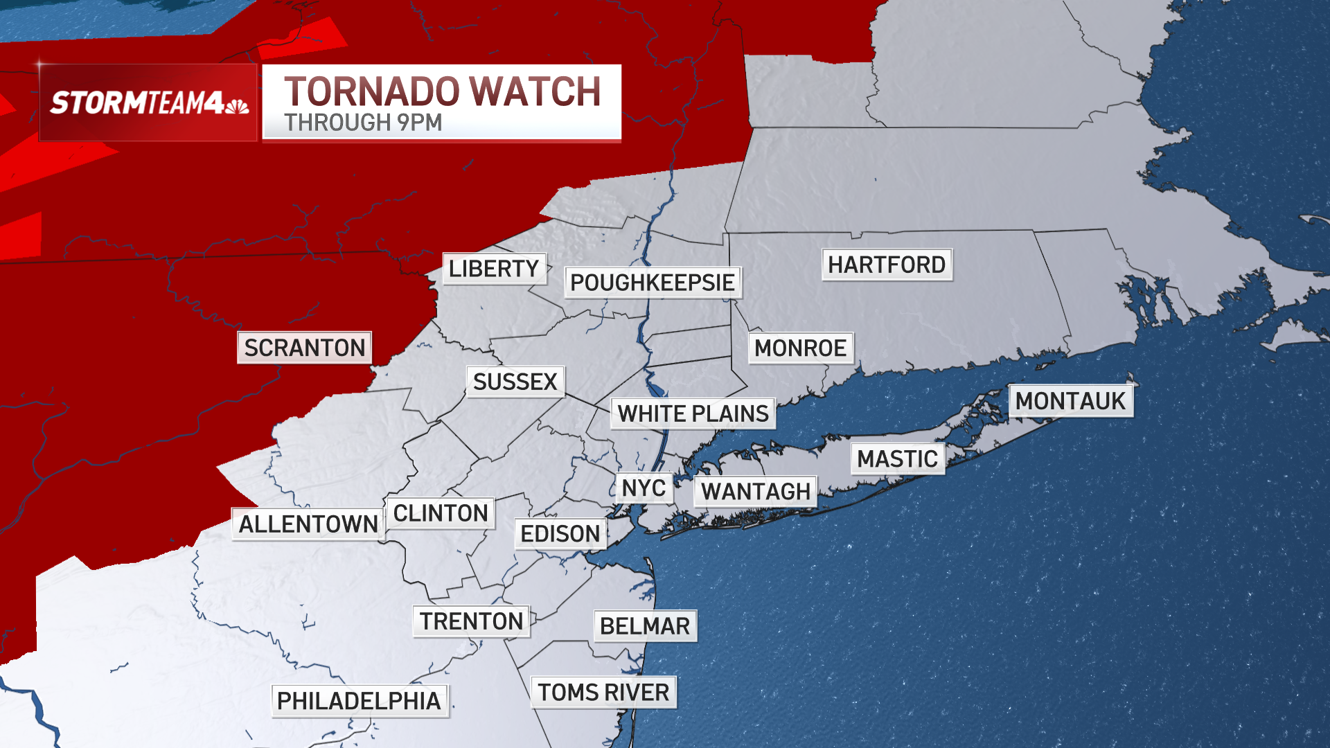
There is even a slight chance for isolated weak tornadoes.
Most of the Hudson Valley and parts of Sussex, Warren, and Passaic County fall into the tornado risk area from Wednesday into Thursday.
If you live in any of these areas, be sure you can get weather alerts on your phone, especially if you plan to be in northern Sullivan, Ulster, or Dutchess counties, where the tornado threat appears greatest.

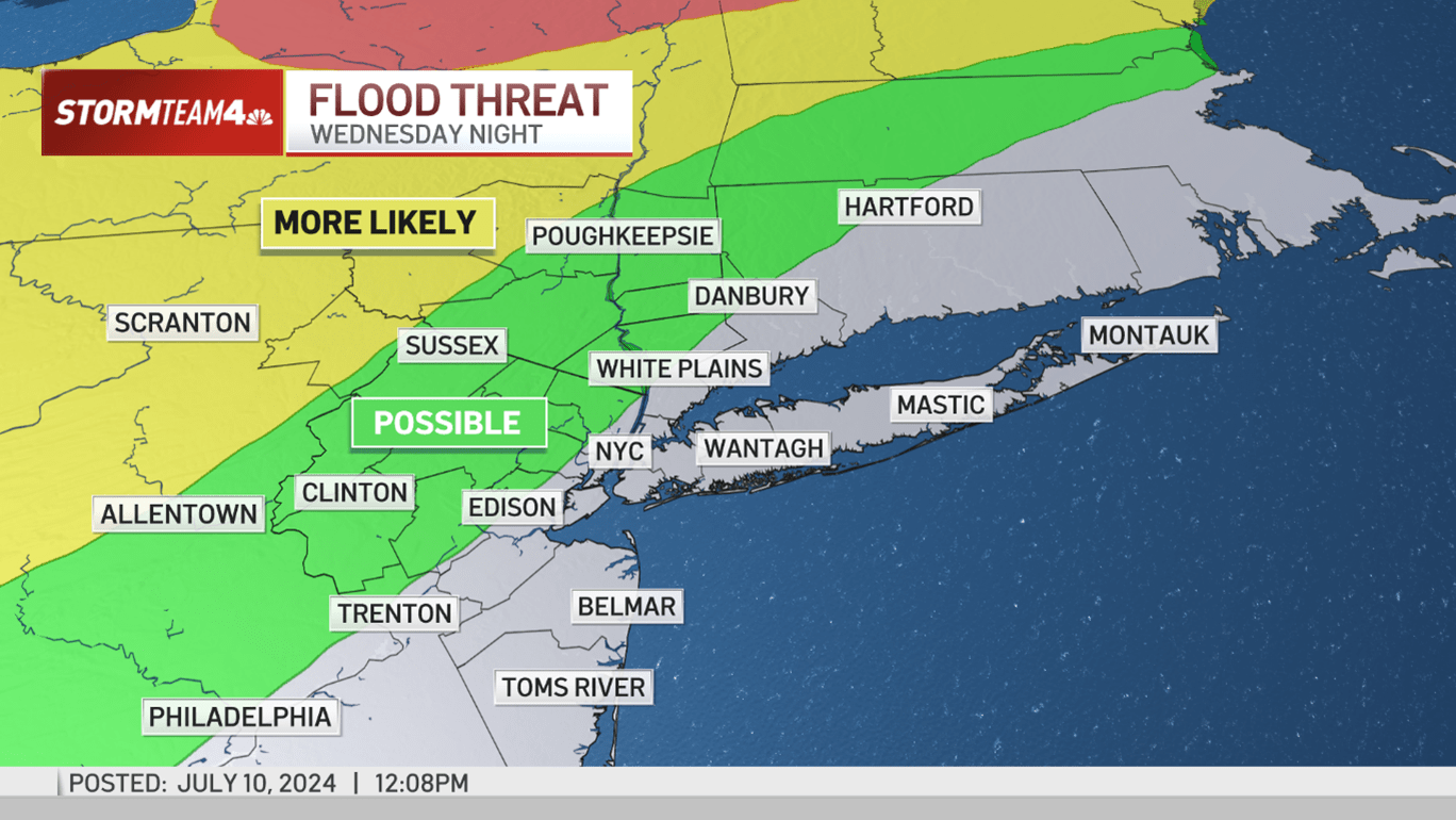
Storms could also bring locally heavy rainfall north and west of the I-95 corridor, thanks to the ample atmospheric moisture in the region.
The greatest flood potential for flash flooding will be in Central and Northern New York, but areas from the Poconos and Catskills east to the Mid-Hudson Valley could also face minor flooding. Rainfall rates could be over an inch per hour amid the heaviest downpours on Wednesday night.
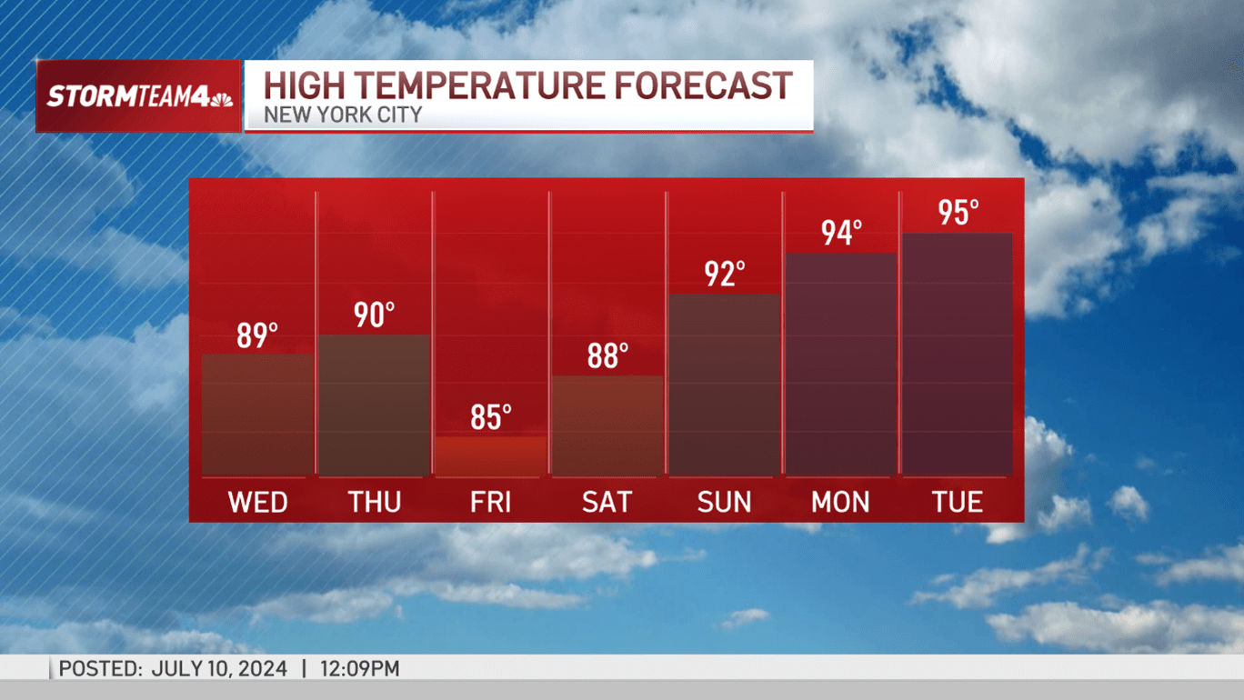
Spotty storms will continue to bubble up through the end of the week, especially during the hottest part of the day. Severe weather is unlikely on Friday and Saturday, but heavy downpours are possible from some storm cells.
The storms will bring slight heat relief early this weekend, but it won’t last long. Starting Sunday, we’re predicting another heat wave for next week.

Track any approaching rain or storms using our interactive radar below.
