Latest Forecast From Storm Team 4
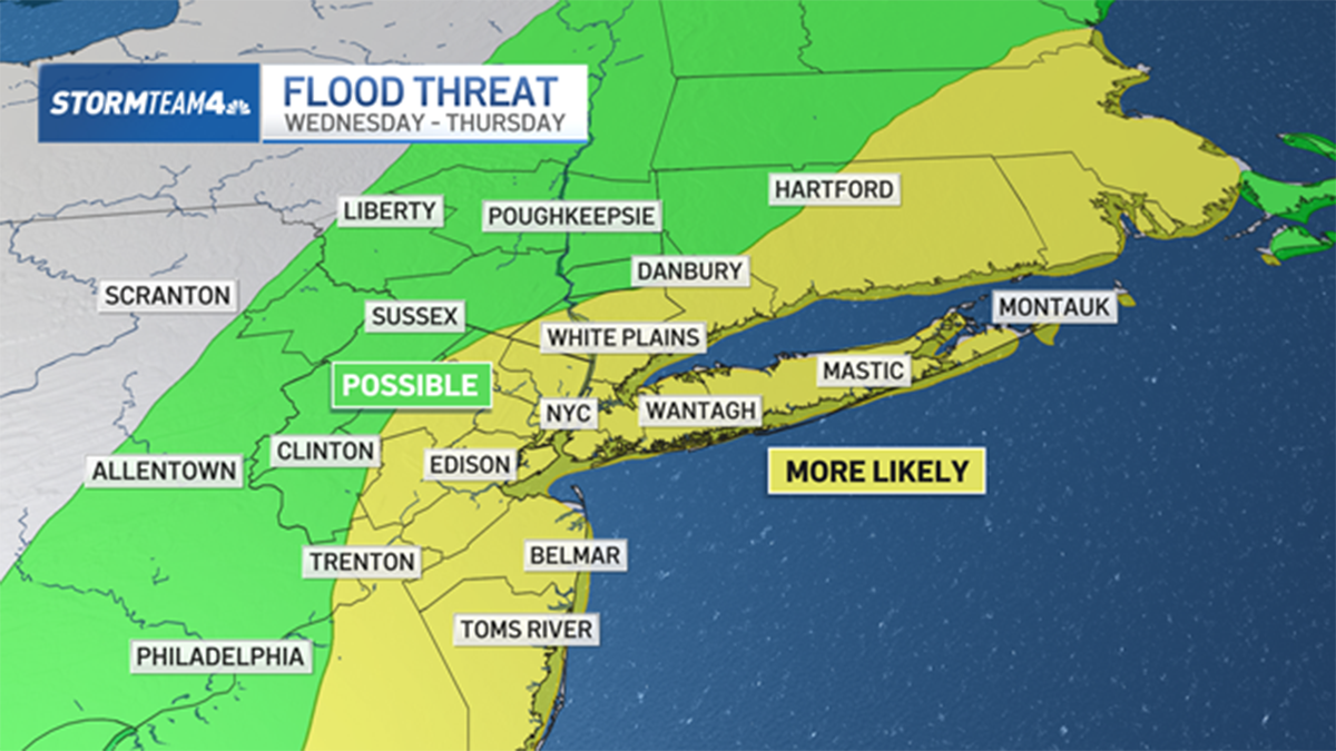
Heavy rain overspread the New York City area Wednesday evening, and it could bring the potential for flash flooding and ponding on roadways into Thursday morning
The steadiest, heaviest rain started Wednesday night and stuck around for hours. There is potential for widespread minor flooding, with some areas possibly seeing more significant flooding. Minor river flooding is also possible in the next day or so, especially near the usual suspects (like the Passaic and Millstone rivers).
New York City issued a travel advisory into Thursday, as some flood-prone roads may become impassable. The primary flood threat was set to end around midnight, though residual flooding is possible through the morning, the city's Emergency Management Department said.


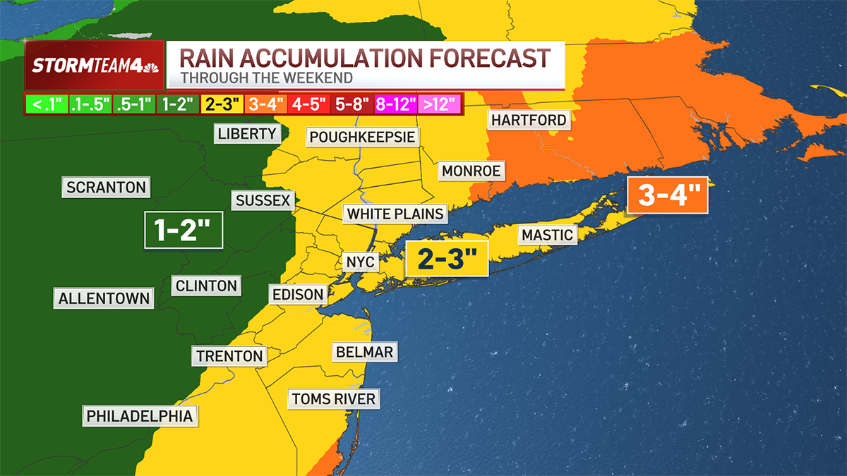
A flood watch has been issued for a swath of the tri-state area from until 6 a.m. Thursday. The biggest flooding risk is for areas east of NYC, on Long Island and parts of coastal Connecticut, where the highest rain totals will be. Check the latest severe weather alerts for your neighborhood here.
Ultimately, a widespread 2 to 3 inches of rain is expected, with locally higher amounts possible, by the end of the week.
Get Tri-state area news delivered to your inbox. Sign up for NBC New York's News Headlines newsletter.

Weather Stories


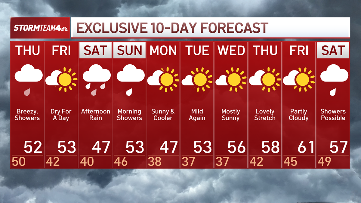
The wet weather continues Thursday, which will be windy, as gusts pick up a bit. Isolated flooding remains a concern, though it will be mostly lingering showers, not nearly as steady or widespread as Wednesday's storms. Skies finally clear out by Thursday night.
The lone decent day looks to be Friday, which will be dry. But after three days of rain, much of the ground will still be waterlogged, so not exactly ideal conditions for heading to the park for a picnic.
The weekend doesn't look to provide much respite either. More unneeded precipitation could come Saturday afternoon into Sunday.
If there is some good news, it's that it will be far too warm for any snow to develop. The high temperatures each day will be in the mid-50s, eliminating any chance for a late-season snowstorm (at least for now).
Next week starts off gusty and chilly before a warm-up arrives just before midweek. Some of the wind chills on Monday will make the commute feel January-like. But it does get better after that.
Check out the 10-day extended forecast and our interactive radar below.