Latest Forecast From Storm Team 4
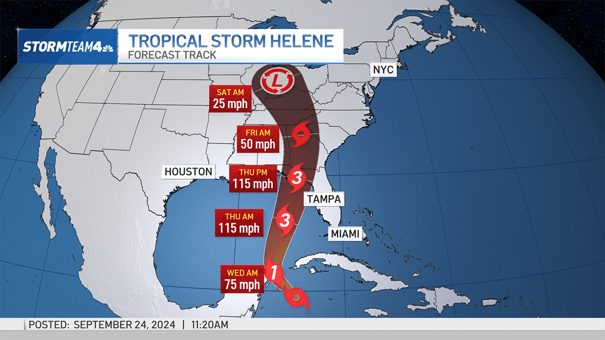
Tropical Storm Helene has formed in the northwestern Caribbean Sea and is expected to rock the Florida Gulf Coast later this week as a Category 3 hurricane.
Current sustained winds are 45 miles per hour as it tracks northwest at 12 miles per hour.


Helene will strengthen quickly as it brushes the Yucatan Peninsula near Cancún early Wednesday morning. By then it will likely be a Category 1 hurricane.
Once Helene enters the Gulf of Mexico it will strengthen quickly into a major hurricane as it zeros in on the Big Bend area stretch of the Florida Gulf Coast. This is one of the most sparsely populated sections of Florida’s coastline.
Get Tri-state area news delivered to your inbox. Sign up for NBC New York's News Headlines newsletter.
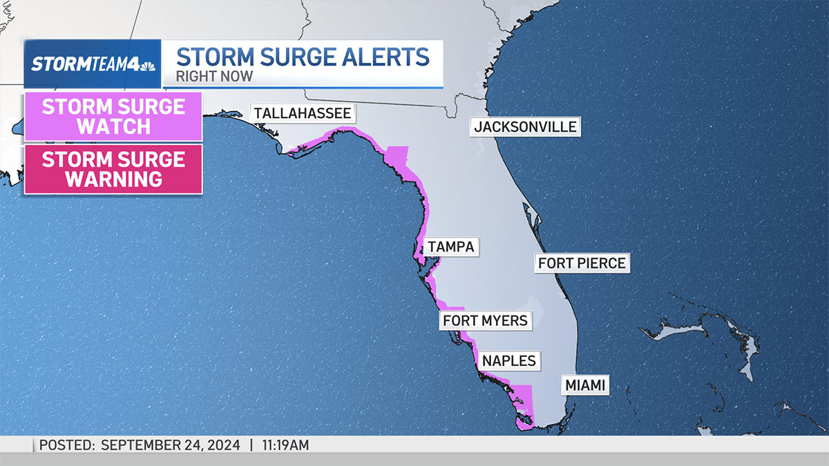
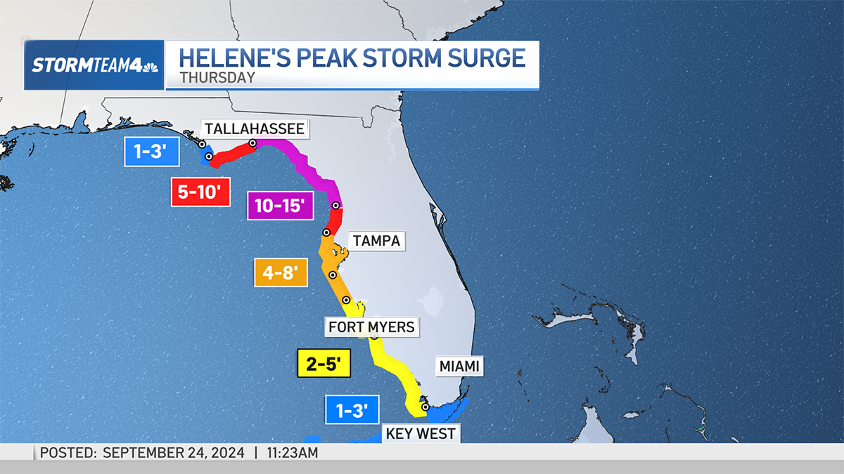
Hurricane force winds as high as 115 miles per hour will cause considerable damage to areas near the eye of the storm. Surge will be a more widespread problem for Florida.
Near the eye, storm surge could be as high as 15 feet. Further away, in the Tampa Bay area, peak surge could be as high as 8 feet, which will cause significant coastal flooding. Surge will be steadily lower farther south, along the beaches of Fort Meyers, Naples and the Florida Keys.
Weather Stories


Helene is expected to move inland at a fast pace, which will help to keep overall rainfall totals lower than if it was a slow-moving storm. Rain totals up to 8 inches are possible in northern Florida.
Further inland, as Helene begins to weaken and slow down, rain totals could increase to as much as a foot in North Georgia, South Carolina, Eastern Tennessee and Western North Carolina. Flash flooding will be a big concern in these regions into Friday.

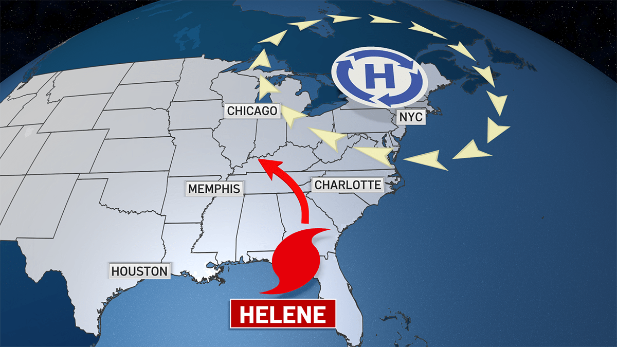
For the tri-state area, Helene is expected to have no impact. A well-timed ridge of high pressure will set up over the Northeast and deflect the remnants of Helene west, into the Midwest, by the weekend.
That high pressure is expected to deliver nice weather to the tri-state on both Saturday and Sunday.