It may be cliché, but it's also true: We needed the rain. But the timing and severity wasn't exactly ideal for those heading home after work.
Although Monday started out dry, the evening was everything but as the threat of severe weather descended. The gray, humid afternoon eventually turned over as storms started to smack the tri-state during the dinner hour.
Check the latest weather alerts for your neighborhood here.
Get Tri-state area news delivered to your inbox. Sign up for NBC New York's News Headlines newsletter.
Gusty winds and heavy rain started to develop shortly after 7 p.m. for New York City.
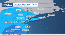
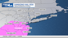
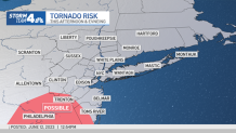
Nearly the entire tri-state area was warned of the chances for destructive winds, while much of New Jersey had the threat of hail, and more western portions of the state threatened by flash flooding.
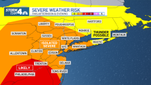
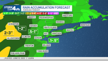
Overall, the storm threat hasn't been the same for every part of the tri-state, and not all areas will see severe conditions. But the threat remains in tact starting in the evening and lasting through dinner time, stretching possibly until after midnight.
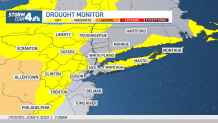
The rain is needed because much of the area has been quite dry lately. Dry conditions expanded across a good amount of northern New Jersey late last week, and much of Pennsylvania is in "moderate drought" territory.
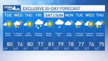
After a pleasant Tuesday, another chance of storms returns Wednesday. The remainder of the work week looks dy and warm, with highs topping 80 degrees.
News
If you had plans of doing something outdoors for Father's Day, better move those plans to Saturday, as Sunday looks like it will feature some showers.
The unsettled weather pattern continues into early next week, with thunderstorms possible for the last few days of spring. Take a look at the 10-day forecast below.
