Latest Forecast From Storm Team 4
The good news is few and far between this week.
NYC tallied its second heat wave of the year on Sunday as high temperatures soared into the 90s for the third consecutive day. That heatwave extended to four days on Monday, and should hit five Tuesday.
In fact, we're staying in the 90s all week, so stick close to air conditioning if you can or pack around one of those handheld fans.
Watch NBC 4 free wherever you are
NYC COOLING CENTERS TO STAY OPEN THROUGH WEDNESDAY — CLICK FOR DETAILS

Get Tri-state area news delivered to your inbox with NBC New York's News Headlines newsletter.
It’s not just the sweltering temperatures across the tri-state: Humidity is making this surge in temperatures dangerous.
Weather Stories
The week kicks off with another heat advisory -- this one in place for much of the region for Tuesday and Wednesday until 8 p.m. And though the temps should hang around the 90s, it'll feel closer to 100.
That level of stifling heat is concerning for any amount of time, but is especially devastating when it persists over multiple days. Heat takes a physical toll on the body that is only exacerbated by prolonged exposure.


Remember we said there wasn't much in terms of good news? Even when temperatures are back in the 80s later in the week, heat indices will remain in the 90s. Stay hydrated and take it easy when outside.
Check on your relatives and neighbors, especially if they tend to be more vulnerable to the heat.
It's not just the daytime highs that will make this week difficult — it’s the lows, too. Overnight temperatures are staying in the mid to upper 70s.

These warm overnight temperatures work in tandem with high humidity and light winds to make for some stuffy summer nights that prevent any meaningful relief from the heat. As a result, access to air conditioning or cooling centers becomes essential; without it, the body struggles to keep temperature regulated.
Coming along with this dangerous heat is poor air quality. Air quality alerts are in effect through 11 p.m. Monday, warning of higher amounts of ground-level ozone, a pollutant produced when emissions react chemically with heat and sunlight.
Enough ground-level ozone is expected on Monday to be unhealthy for those with preexisting respiratory or heart problems. This is yet another reason to avoid spending extended periods of time outside.

In addition to the heat and lingering humidity, it would not be hot and humid summer weather without the chance for storms. For the most part, that'll get started on Tuesday, and all week there is a near-daily chance for at least a pop-up shower within the region.
Monday does have the chance for an isolated shower, but mostly we'll stay dry.
By midweek, storm chances are looking a little more widespread and impactful. Most of us get a shot at a storm on Tuesday and Wednesday. Along with gusty winds, heavy rainfall will be a major concern.


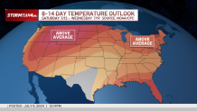
But these storms will not be wiping out the humidity: There is almost no relief from the hot temps and humidity over the next 10 days (sorry). We've even got another potential heat wave on the horizon for next week.


Track any approaching rain or storms using our interactive radar below.


