
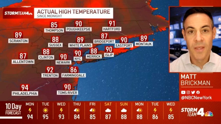
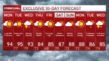
After what has felt like unrelenting heat, storms and everything in between, there is a fresh round of unsettled weather and stifling temperatures that will hang around for half of the week.
A handful of heat advisories and excessive heat warnings are in place through Wednesday morning.
Check the latest weather alerts for your neighborhood here.
Watch NBC 4 free wherever you are
Get Tri-state area news delivered to your inbox with NBC New York's News Headlines newsletter.


Think of Sunday as the appetizer before the main course. Monday, Tuesday and Wednesday will all have heat indices climbing past 100.
Weather Stories
Stray evening storms are possible through Tuesday (which looks like the hottest of the week), then a cold front comes through on Wednesday afternoon and evening, bringing a storm and potentially severe storms behind it. Cooler, less humid air moves in to finish the week.

If it's feeling like the hottest year in recent memory, it's not just in your head (or your sweat).
Storm Team 4 says 2024 is now the hottest year on record (to date). Our recent stretch of heat has helped bring our average temp just above previous records of 2012 and 2023.

Central Park has also hit 90 degrees 11 times so far this year (as of 7/13), with more 90-degree days expected this week.
Track any approaching storms using our interactive radar below.