What to Know
- Henri weakened to a tropical storm early Sunday but is still expected to wreak havoc across the tri-state area into Monday
- As of the National Hurricane Center's latest update, Henri is 100 miles northeast of NYC and moving west-northwest at 7 mph. Its maximum sustained winds remained near 40 mph
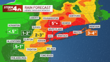
- Henri could ultimately produce rainfall amounts of 3 to 6 inches over Long Island, NYC and northern NJ Sunday into Monday, with isolated maximum totals near 12 inches. Destructive winds are expected
A weakened Henri made landfall Sunday afternoon along the coast of Rhode Island with maximum sustained winds around 60 mph, though tropical storm conditions will continue for parts of the tri-state area. Flash flooding remains a huge threat.
Henri is expected to slow down and possibly stall near the Connecticut-New York border Sunday night, according to the National Hurricane Center, which could turn already difficult flooding problems into potential catastrophes. By Monday, the storm could move across northern Connecticut or southern Massachusetts in the afternoon. Track live radar and see the latest conditions here or within the player above.
Watch NBC 4 free wherever you are
States of emergency for Connecticut and two dozen counties in New York, including the city, remain in effect amid the devastating rain, while torrential downpours are stranding drivers in floodwaters in multiple states. Isolated maximum rainfall totals of up to 12 inches are possible in the affected areas.
Get Tri-state area news delivered to your inbox with NBC New York's News Headlines newsletter.
As of the National Hurricane Center's latest update, Henri is 100 miles northeast of NYC and moving west-northwest at 7 mph. Its maximum sustained winds remained near 40 mph with higher gusts. Tropical-storm-force winds extend outward up to 35 miles from the center.
Henri will likely become a tropical depression by Sunday evening as the storm continues to weaken over the next couple of days, the NHC says.
The hurricane warning and tropical storm warnings that were in effect for much of the tri-state had come to an end by the NHC's 5 p.m. update. The storm surge warnings were up as well, leaving only a widespread flash flood warning for parts of NYC, northern New Jersey and the Hudson Valley through 8:45 p.m.
Henri had moved inland and was expected to continue to slowly weaken as it moves over Connecticut Sunday. Wind gusts to tropical-storm-force winds are still possible across the Connecticut and Long Island coastline in the next several hours. Track live radar and see latest conditions here.
The heavy rain produced by Henri will continue to result in considerable flash, urban and small stream flooding, the agency said in its latest update.
Gov. Andrew Cuomo said in a storm briefing Sunday that the state was "doing the best we can" to move sand to protect the shoreline, but he described the expected storm surge as "something to be concerned about." The state has deployed 500 National Guard members and 1,000 state police personnel for storm response.
The storm has already produced record rainfall of 3 to 6 inches over the New York City metro area -- including a historic 4.45 inches within two hours in Central Park on Saturday night, the National Weather Service said. With 1.94 inches between 10 p.m. to 11 p.m., it was the rainiest hour in 150+ years of recorded history.
Brooklyn had seen almost 8 inches of rain by 1 p.m., while parts of New Jersey also saw intense rainfall with more torrential downpours still ahead. Middlesex County had more than 8 inches recorded by 8:30 a.m.
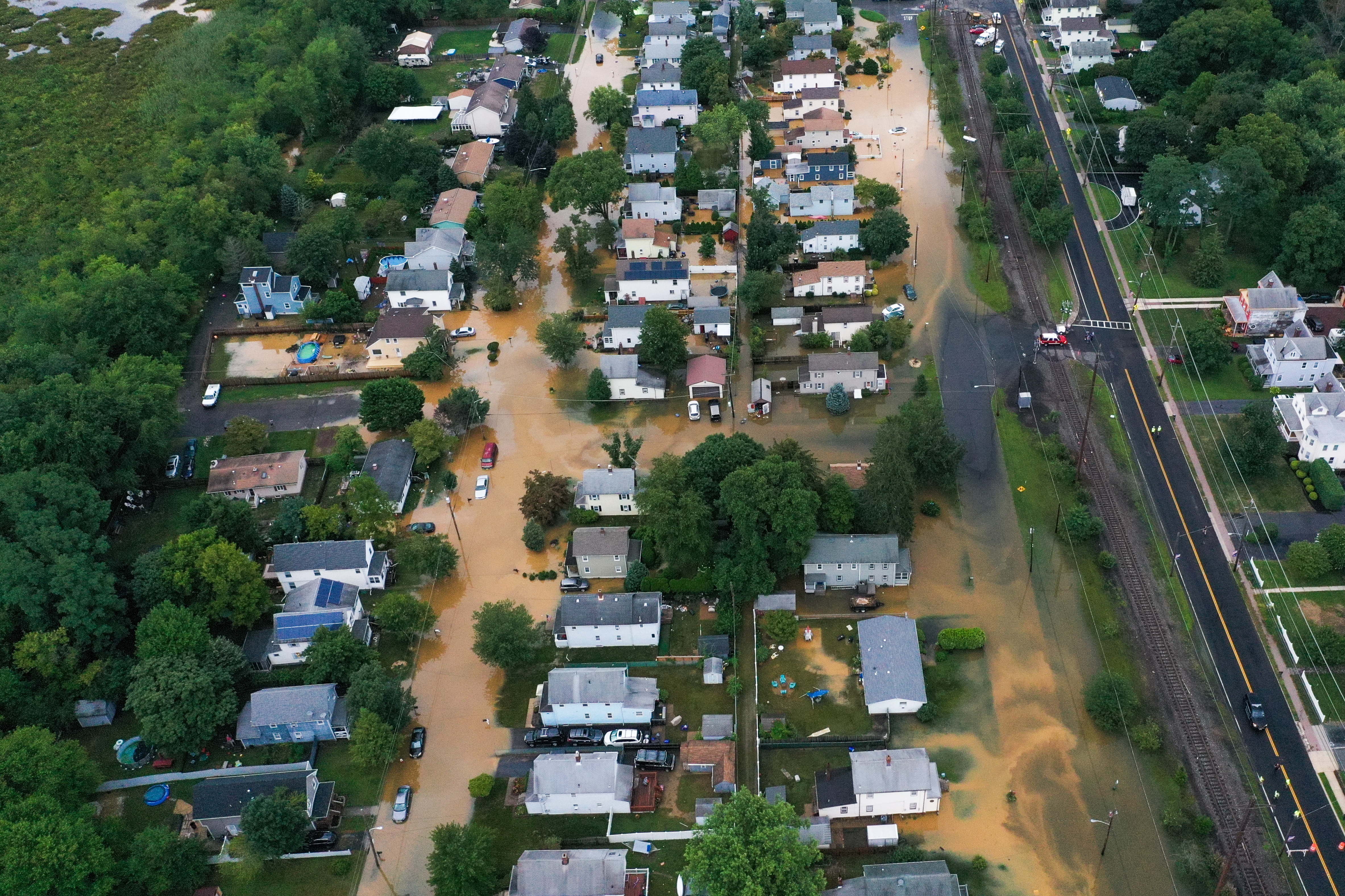
A team of police, firefighters and emergency response teams in Newark rescued nearly 100 people from dangerous flood waters. City officials say 86 people, including 16 children, were extricated from submerged vehicles.

Flash flood warnings have been triggered across the tri-state area. See the latest weather alerts for your neighborhood here. There have been multiple reports of vehicles stranded in parts of the city, northern New Jersey and Long Island. Transit officials are urging people to stay home if at all possible.
Expect conditions to worsen in southeast New York, northern New Jersey, New England and on Long Island Sunday into Monday, with isolated maximum totals near 10 inches. Flooding rains could also hit eastern Pennsylvania, New Jersey, the Catskills and Hudson Valley as the storm slows down.
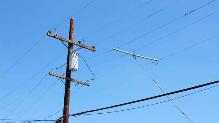
Henri is expected to cause devastating power outages across the region. Nearly 10,000 were in the dark by 9 a.m. and outages were expected to worsen over the course of the day. Click here for the latest updates on outages by county.
Some utility companies in the tri-state have warned customers they could be without power for up to 14 days, depending on the severity of the storm. Hundreds of flights across New York's airports have been canceled. Get real-time transit updates here.
Lightning strikes and the threat of severe weather showed up before 8 p.m. in the city, halting the homecoming mega-concert in Central Park.
All NYC Health + Hospitals COVID-19 testing sites and COVID vaccine sites located at hospitals are closed Sunday as well. State parks and historic sites are also shuttered, officials announced.
Cuomo, whose sex harassment scandal-forced resignation takes effect at midnight Tuesday, declared a state of emergency in New York City, Long Island and the Hudson Valley ahead of Henri. Connecticut Gov. Ned Lamont's emergency order remains in effect for his state, while New Jersey continues to monitor impacts.
President Joe Biden approved Cuomo's pre-landfall emergency declaration as well as one requested by Connecticut Gov. Ned Lamont, which will funnel immediate federal assistance to the states.
Tracking Henri
New York City's Office of Emergency Management continues to closely monitor Henri. Open Restaurants outdoor seating and Open Streets are suspended.
Mayor Bill de Blasio urged New Yorkers to stay home at peak storm times if they can, noting more than 6 inches of rain with 3-4 feet of coastal flooding are possible in northern Queens and the Bronx along with up to 50 mph wind gusts Sunday.
Ocean swells generated by Henri are expected to increase across much of the east coast Sunday and continue into Monday. Those could cause life-threatening surf and rip current conditions, according to the National Hurricane Center.
Track the storm using our interactive radar below.


