NYC Sanitation Commissioner Jessica Tisch famously said in 2022 that "the rats don't run this city, we do" — but a newly launched map showing rodent-related violations shows it may be closer to a 50/50 split.
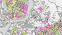
The color-coded and searchable map was introduced Tuesday. It breaks down at a building-by-building level what places passed their last inspection, where there was recent rat activity, what spots had failed for another reason, and which had not been inspected in the past six months.
Users can either search for an address, or simply click on the map for results. Selecting a community district can also narrow what the map shows as well. Once an address is selected, the Health Department information will pop up, showing when the last inspection was, what type of inspection it was, the result, and the number of inspections at the property since 2015.

Any place that has not had an inspection within the past six months was greyed out on the map, but the inspection and action history is still available.
So what areas scored the best — and where had the most recent violations? It all depends on what neighborhoods you're looking at.
Get Tri-state area news delivered to your inbox. Sign up for NBC New York's News Headlines newsletter.
Much of Greenwich Village, the East Village, SoHo and down into the Lower East Side showed as having passed last inspection, according to the map, though there were some areas that did not. In Manhattan, the map doesn't turn to majority pink (indicating rat activity at last inspection) until further north on the Upper East Side and Upper West Side, and up into Harlem.
There is a mix as well in much of Upper Manhattan and into parts of the South Bronx.
To look at your neighborhood, or your specific address, check out the map here.


